I'm a double cancer survivor, cyclist and walker who does various challenges for different charities, mainly cancer-related.

In 2016 I climbed every single 'Birkett' in the Lake District - all 542 fells over 1,000' within the National Park, including all 214 Wainwrights. I've also done a three-week cycle tour of Tasmania in February 2015 and amongst other things, I've cycled from Land's End to John o'Groats (2003), Rotterdam to Lemvig (Denmark) (2005), walked the Pennine Way (2008) completed (my first) ascent of all 214 'Wainwrights' in the Lake District in only 55 days (2009), cycled 4,500 miles around the coast of Great Britain (2011), cycled all 42 of the accessible Western Isles of Scotland in under a month (2012), twice abseiled 230 ft from the top of The Big One in Blackpool, cycled the WWI Western Front from London to Compiegne via Ypres and Arras (2014), cycled 750 miles in the Yellowstone National Park and Grand Teton (2014), done a bit of sky-diving and cycled Australia's Great Ocean Road - just before lockdown in 2020.

Altogether I've raised over £120,000 for my charities including The Christie, Cancer Research UK, the Rosemere Cancer Foundation, and ABF (The Soldiers' Charity) and I was mightily chuffed to receive the British Empire Medal in the 2014 New Year's Honours List.

I'm a Rotarian and give illustrated talks about my adventures in exchange for a donation to charity, so if you're looking for a speaker leave me a message. I am also Event Organiser for the Ribble Valley Ride Cycle Sportive, to be held this year on Sunday 5 September 2021 - more details at www.ribblevalleyride.org

You can also follow me on Twitter - @CancerBikeMan and on Facebook - just search for Bill Honeywell

Cancer Research UK is the world's leading charity dedicated to beating cancer through research, whilst The Rosemere does fantastic work for patients in Lancashire and South Cumbria.

Tuesday 31 May 2011

Day 19 – Durness (NW corner) to Dunnet Bay (NE corner)

79 miles, making a total of 1,326 so far.

I was absolutely freezing when I woke up, and tomorrow is the first of June! There was a big black cloud lurking to the south, but in other directions it was clear, so perhaps it boded well for a dry day.


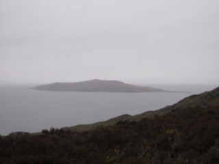
After the usual 8.00 start we passed the Smoo Caves with its interesting stick-man sign and then wondered why Durness should have a John Lennon memorial.  We had to go several miles south along one side of Loch Erribol, then turn at the head and go back north along the other side, where there was a Great Northern Diver lurking off shore.  At this point we also encountered the only real shower of the day, which I have to say is a big improvement.  We’ve been hearing lots of Cuckoos, and on this stretch – unusually – we saw two.  They look a bit like a grey Kestrel.


After a quick stop on the moors between Loch Hope and Tongue (where a passing cyclist kindly gave us £10 after we told him what we were doing) we crossed the Tongue causeway but then by-passed the town by a more coastal route.


The road now became a long roller-coaster that lasted for much of the rest of the day – a never-ending series long ups and downs. At Bettyhill there’s the Strathnaver Museum, telling the tale of the area from Bronze Age to one of the most infamous episodes of the Highland Clearances.  A downhill section section in the 30 mph zone found us doing 35 mph and Mick (who is a driving instructor) feeling guilty!


Mark and Sandra have so far done well in finding parking spots with a view, but this afternoon they excelled by parking next to the cemetery in Reay. It wasn’t even quiet, as a council employee was cutting the grass.


On past the partly-decommissioned Dounreay nuclear power plant (no more jokes about me glowing, please!) with the wonderfully ironic juxtaposition of six nearby wind turbines (two of which aren’t working – even more ironic), and then to Thurso, easily the biggest town on the route today.

From there it was an easy few miles in the late afternoon sunshine (yes, sunshine) to the Caravan Club site at Dunnet Head, where I was admonished by the warden for cycling in the WRONG WAY, against the One-Way system (“Health & Safety you know”)

Actually, today has been a day of signs – here are just a few:

Smoo Caves, nr Durness – A Matchstick-Men sign saying “Danger – People Below”
Loch Resipoll – Home-made chevrons at a left-hand bend to stop drivers overshooting on to someone’s drive
Car stickers in Tongue saying “I LOVE TONGUE” (I’m a boiled ham man myself…)
On a loch side underneath overhead power lines – “Cast Carefully”


Bettyhill Stores “Open 8 Days a Week”
In Thurso – “ZEBRA CROSSING – Drivers MUST Give Way (Highway Code)”
At the caravan site – “SERVICES – No payphone”

Almost a rest day tomorrow – fewer than 30  miles, but including a visit to Dunnet Head (Britain’s most northerly point, despite what the Rotary Quizmaster said a few months ago!) and Duncansby Head, which is the most north-easterly point. We’ll be staying at John o’ Groats, which is neither. If anyone can explain why it should be Land’s End to John o’ Groats rather than Dunnet or Duncansby Head, please let me know!

Monday 30 May 2011

Cancer Research UK

Finally today, can I thank all the people who have donated so generously up to now - your money will help much-needed research and will save people's lives in the future.  The fact that you are donating is one of the things that have kept me going during the absolutely 'orrible weather of the last few weeks.

The total amount donated or pledged is now approaching a fantastic £7,000 - over a third of my £20,000 target, with less than a third of the ride completed - so I hope this is a good sign.  If you haven't already donated, please consider doing so by visiting either http://tinyurl.com/cancerbikeman or http://www.justgiving.com/Bill-Honeywell.

That's it for now, I'm going to have an early night with a good book before starting it all again tomorrow.  Thanks for reading!  Bill.

PS There are also a lot of generous people on Twitter. If you are a Tweeter, please 'follow' me, and if you are already following, please put out a shout to all your followers to do likewise.  As they say down at the corner shop, "Every Little Helps."

What a Difference a Day Makes…

Day 18 – Achmelvich to Durness – 59.6 miles

Al set off for home last night and got as far as Aviemore before diving into a Bunk Barn and getting some well-earned rest.  Last night I got to looking back on Al’s involvement in the week – the wettest, stormiest week I can remember.  On the first morning when the weather was really wet, he found the Smoke House at Port Appin with scones and coffee; then we were hit by the storms and when the tree fell on the van he was a great help co-ordinating the chain-saw men and making sure the van wasn’t further damaged; as the gales hit us again on Tuesday he managed to keep going around Kingairloch; and on the Bealach na Ba, when the weather was at its absolute severest, he kept his head, we got safely to Applecross, and managed to finish it off the following day. Yes Al, I’m beginning to think you’re a jinx!! (Only kidding old chap!)

I have a new cycling companion this week. Mick Bryan, who has been driving the van for the last three days, handed the keys over to my son Mark (@DoctorTweak) and his wife Sandra and put on his cycling gear, promising to bring some better weather.


Suilven from the Coastal Road

After a heavy shower during breakfast, the first thing on the agenda today was to negotiate what has been called ‘Britain’s Hilliest Road’ – the Coastal Road from near Lochinver to Kylesku.  It started with a big climb but then we were beginning to wonder what the fuss was all about, whilst enjoying some fantastic scenery.  We were (of course) hit by another bitterly cold shower but at least the rain wasn’t permanent.  After Dunbeg the hills became steeper, longer and more frequent, with some long, long climbs and descents, and a wicked stretch of 1 in 4 which took some effort.  But all the time the scenery was magnificent and when we reached the junction we knew that the experience had been well worth it, even though in that 21-mile stretch we had climbed more than the height of Ben Nevis!


Quinaig


From there on, the main road to Durness was a roller-coaster of long ups and downs, whilst the weather decided to get better and better.  After lunch at Laxford Bridge (I don’t think there’s anything there except a bridge…) a long gentle climb took us to the watershed, from where we enjoyed a fast descent of several miles at speeds of over 25 mph, with the sea off the north coast in view.


So here we are, having just turned the corner at the north-west corner of Great Britain.  Tomorrow we head east to Thurso, and after a rest day on Wednesday, we’ll be heading south. Progress. And we’re still on schedule, phew!


It’s lovely here in Durness - although it’s a chilly wind – with a great view over the sea.  We’re getting near the North Pole so it won’t be dark for long!  Early night tonight for a long-ish day tomorrow – 79 miles and for the third day running, plenty of climbing.

Oh, and finally the total:  1,247 miles completed (2,706 to go!)

Day 17 – Gruinard Bay to Achmelvich - 75 miles

If you’ve ever fallen asleep in the bath, then woken up an hour later when it’s gone cold, you tend to remember (a) how cold it feels and (b) how your skin looks like something related to a wrinkled prune.  Now, try to imagine being in the bath for five hours, and you’ll have some idea what today was like.


Gruinard Island ("Anthrax Island")


An Teallach

The light rain that greeted the day seemed almost benign. Remember, this is Day 17, and on EVERY day except Day 1 it has rained. Sometimes for the entire day, and sometimes very heavily indeed. So I ended up thinking “I’ll take that” when all the weather could provide was light rain.  But soon it turned heavy.  An hour into the ride it was lagging it down, as they say in Yorkshire. Lloviendo a cántaros, as they say in Madrid. When we’d climbed forever up to the top of the pass south of Dundonnel and started the long, long descent, it was making my stair rods look anorexic, and the road took on the appearance of a riverbed.


We were drenched, absolutely drenched, despite the full waterproofs. Because enough rain was falling on my head to run down my neck and inside my clothing. Al discovered that his once his waterproof socks filled up with water, it couldn’t go anywhere but out at the top.


At the bottom of the pass we had a few miles of respite as the wind was behind us, but soon, as we approached Ullapool, it swung round into our faces, the rain STOPPED and the sun came out.  This state of affairs lasted for ten minutes, until the showers arrived.  And what showers!  Almost overlapping, every fifteen minutes, torrential and then with big hailstones.  Not nice.


North from Ullapool we took the scenic coastal route past the ridiculous mountain called Stac Pollaidh – an incredibly steep little monolith that looks so out of place, but a proper mountain. This road is incredible, with different views around every corner for the whole of its 20-odd miles, before you arrive exhausted – physically and mentally – at Lochinver, a small fishing port with a particularly impressive war memorial.

Cycling like this plays havoc with your emotions.  You’re either up or down, but it’s like a roller coaster, as follows:

UP – a good start, only light rain
DOWN – the rain gets heavier
FURTHER DOWN – rain of Biblical proportions, every inch of body saturated
UP – tailwind, rain stops
DOWN – wind gets stronger and turns into headwind
FURTHER DOWN – heavy showers start
EVEN FURTHER DOWN – showers turn to hail
UP – showers stop
FURTHER UP – a patch of blue sky
EVEN FURTHER UP – Wow!! Stac Pollaidh, Suilven, vintage French cars, photogenic group of cows and calves
A BIT DOWN – Road keeps going up and down, it’s taking a long time to get to the finish
BACK UP – Arrive at finish, Achmelvich beach looks idyllic (if only it were 20° warmer!)


Alan left tonight, as new van crew - son Mark and daughter-in-law Sandra arrived for a week’s stint.  Alan’s parting words were “Well, I’ve had a wonderful holiday, but this wasn’t it!” (apologies to Groucho Marx).

Sunday 29 May 2011

Day 16 – Kinlochewe to Gruinard Bay

At last! A short ‘rest’ day – only 34 miles of cycling to do on easy terrain before putting my feet up.  Experience has taught me that you can’t walk or cycle moderate or long distances day after day without a rest: it may be OK for the under 30’s but for the only-just-under-60’s it will only lead to disaster.  Not that the weather is having any time off though – it seemed to rain right through the night and this morning was a case of (hardly any) sunshine and showers.  It did make a nice change to see a shadow at one time, I must admit, after I’d got over the initial shock.


The main road NW from from Kinlochewe runs alongside Loch Maree, which is dominated by the mass of Slioch, a bulky-looking Munro which was, of course, mainly topped by cloud today, especially as we were ‘dumped on’ by a heavy shower.  One amazing sight was a convoy of 25 Italian motorhomes, all heading south, presumably having had enough Scottish summer for one vacanza. Bringing up the rear at no. 25 was a  massive all black half-motorhome half-coach: most impressive!


Although an ‘A’ road, it becomes single-track and rises to a freshwater loch where, at about half-distance, we stopped in a lay-by to ‘refuel’.  Another motorhome stopped and the driver, from Burnley, gave us a generous donation for Cancer Research UK.  Whilst in the motorhome an evil heavy shower passed over, which was good timing.


Gairloch next, where there is a branch of the Bank of Scotland all on its own outside the village. The ATM must do a roaring trade as there was a big car park and plenty of custom when we got there – just in front of a lady from Colne (is there anyone left in Lancashire?).


Just before Poolewe there is a great view back up the same Loch Maree that we had cycled along over half an hour before, and just after is the famous Inverewe Garden, 54 acres of garden managed by the National Trust for Scotland.  We were being treated by the occasional patch of sunshine now, but with the occasional heavy shower, just to remind us that we can’t expect any really good weather – not at the end of May, obviously.

Loch Ewe is where the Arctic convoys were based in WWII and there is still evidence in the form of the remains of the old re-fuelling rigs and gun emplacements.  After Aultbea there was a short rise and fall and there we were at Laide on Gruinard Bay – looking across to another reminder of WWII:  Gruindard Island, where experiments were carried out to test Anthrax as a biological weapon.  As a result the island was contaminated with the spores of the fatal bacteria and all access was prohibited until it was disinfected in 1987.  We’re not going across to test it.


There’s an amber alert for the Aurora Borealis over northern Scotland tonight, but as our Logistics Manager Alan Breckell says, “There’s more chance of a second coming than clear skies tonight!”.

Total to date 1,112 miles – about one-quarter distance.  Only 75% of the route left then!  Keep pedalling…

I’m trying to raise £20,000 for Cancer Research UK. So far the total stands at over £5,000, but like the mileage, there’s a long way to go.  So PLEASE visit either the CRUK web site or the Just Giving site via the links on this blog, and MAKE A DONATION to help in the fight against cancer.  Whatever you can afford will be most welcome – thank you!

Friday 27 May 2011

Day 15 – We Don’t Do Failure…

Somewhere East of Applecross to Kinlochewe. 49 miles.

When planning the route initially I factored in a day off once or twice a week, but then decided I might get totally bored, so instead I planned two consecutive short days in their place.  Today was due to be the first one, followed by another tomorrow…

After what I said on yesterday’s blog, and after an evening of torrential rain in Applecross, on the western coast of Scotland, we awoke to light winds and NO rain (!!!)  So, not relishing the prospect of being beaten, we decided to go back up to the top and have a look… where we found that conditions had somewhat improved, and so the decision was made to cycle down the other side to where we had abandoned yesterday, and restart from there.  What a view!  It’s an awesome-looking road, and what a great feeling to get to the top this time.  Job done.


After a fast descent we had a look at the village of Applecross (it was too wet last night). There is a community filling station here where you can pay by card and support the village finances presumably.  As the weather seemed to be improving I tried to take off my waterproof top but only managed a wardrobe malfunction, as I’d forgotten to take off my big gloves first!


The next hour and a half was delightful, as we travelled north with a following breeze around the Applecross peninsula, with Skye and Raasay on our left.  


A dustbin wagon passed in the opposite direction – I asked how far they had to go to empty the wagon and got the answer “Gairloch – and we can pick you up on the way back!” – I replied “Well that would be fine, we’re rubbish!”


From Kenmore to Shieldaig on Upper Loch Torridon, the road undulated constantly, making the going hard work.  There was a Black-throated Diver out on the loch, close enough to see quite well.  It was beginning to rain now, not surprisingly as it had been dry for over two hours.  The big mountains of Torridon looked impressive enough, and would have been better without the veils of clouds across their summits.  I thought it was a bit ironic that the old Torridonian Red Sandstone was formed in desert conditions – if only!  Liathach, Beinn Alligin, Beinn Eighe, An Teallach – all names to strike awe into part-time Munro-baggers like me.  This was the first time I’d seen them, and I wouldn’t have fancied climbing them this week!


We thought there might be a climb on the last ten-mile section but instead, Glen Torridon is remarkably flat, with the gentlest of rises for five miles followed by another gently descent to Kinlochewe, where we finished the day at the Caravan Club Site.  It has a great shower block – heated, with quality shower – pure luxury.  Though on a more mundane level it seems that it was my job to empty the chemical toilet: I hope this isn’t setting too much of a precedent!

No signal for the wi-fi once again, but Al has been to the pub and reckons we might be able to use theirs, so if you are reading this and it’s Friday, you’ll know he succeeded.  Off to Gruinard Bay tomorrow and let’s hope this record-breaking weather decides to behave for once!

Please don’t forget that I’m doing all this – and damn it all, this week I seem to have been getting into a few scrapes as well - to raise £20,000 for Cancer Research UK. So far the total stands at over £5,000, but like the mileage, there’s a long way to go.  So PLEASE visit either the CRUK web site or the Just Giving site via the links on this blog, and MAKE A DONATION to help in the fight against cancer.  Whatever you can afford will be most welcome – thank you!

Day 14 – Another Big Adventure - too far!

Arisaig to Applecross – 65 miles cycled.

This blog began as the story of a cycle ride around the coast of Great Britain to raise £20,000 for Cancer Research UK.  It is fast becoming a saga of Atlantic depressions lining up to outdo each other in terms of the amount of wind, rain and misery they bring.  Don’t forget this isn’t winter: we are now only four weeks away from the Druids getting an early alarm call at Stonehenge, yet here in the NW of Scotland each passing day brings more record-breaking foul weather.

Today was no exception.

Together with ‘big’ Al Taylor, my cycling companion for this week, I left the Camusdarach caravan site at about 7.20 for the five mile ride to Mallaig, to catch the 0810 ferry to Armadale on the Isle of Skye.  We had a fairly big day ahead – 70 miles with a grand finale up the hill voted the biggest and most serious in Great Britain – the Bealach na Ba, or Pass of the Cattle:  over 2,000’ of unbroken ascent before a similar drop into the village of Applecross on the west coast.

A tiny patch of blue sky was the subject of some conversation but it didn’t last more than five minutes.  By the time we had passed some lovely beaches and reached the main Fort William – Mallaig road I thought time was going backwards as it was turning almost dark.

As with most first ferries of the day, there were hardly any cars and not many more passengers on board.  The lady in charge of the reception desk told us it would get stormy again this afternoon, and a lone German foot-passenger bemoaned the lack of a gangway.  We soon reached Armadale on Skye, and by now the wind was driving the most wetting kind of heavy drizzle and the temperature was struggling.  As were we – after a few quick miles the road started to climb, and the fierce headwind, driving rain and temperature of around 6° (yes, SIX degrees!) started to wear us down very quickly.


John and Helen came across in the van on the next ferry, and passed us only a few feet before a lay-by, which John turned into straight away.  I was much relieved to be able to stop for a rest, and was pessimistic about the rest of the day, especially the Bealach na Ba.  However, after a coffee and some cake we were sent on our way, and as we crossed the Skye Bridge and dropped into Kyle of Lochalsh, the rain eased and the wind dropped slightly.


A pleasant hour or two followed, with a visit to the pretty village of Plockton and then a steady run around Loch Carron, at times alongside the railway line.  As we passed through a short tunnel we were overtaken by three Porsches, an Audi and a motorbike – obviously having almost as much fun as we were!


Through Loch Carron, then before the grandstand finish a warm-up – a long steep ascent and descent to Loch Kishorn.  As we turned left after the village of Kishorn to start the final climb the van was waiting with Blueberry muffins for a few more calories and Mick Bryan, our replacement driver for the next three days, arrived and was sent on to the caravan site to book us in before the office closed at five o’clock.


At first the climb was no problem, although now the rain was getting heavier and heavier, and the wind was getting stronger and stronger. At first I thought we would manage, but eventually, about three-quarters of the way to the top, the wind turned head-on and became so fierce that we could hardly stand, never mind ride. We got off and pushed for a while, unable to remount without being dashed to the floor.  But we were getting soaked and very cold. We asked a motorist coming down how far it was to the top – she said still quite some way: so when the next car came up in our direction and stopped to ask if we were OK, we said “No!”, left our bikes near the side of the road and accepted a lift to the top where the van was waiting.  Mick was there too, as both he and John, having seen the conditions near the top, knew we would be unlikely to manage, so we were quickly warmed up, the bikes were rescued, and we were taken down to Applecross in driving torrential rain, a little crestfallen. 

But what else could we do?  There was no point risking being blown off the bike, or getting hypothermia.  And Mark Beaumont had to accept a lift on his round the world challenge, and that didn’t affect the acceptance of his result.  But it’s still a big disappointment.

However, we’ll go back to where we left off tomorrow morning and start again. Providing when we wake up it’s clear blue sky, flat calm and 18°.  And I’ve seen the forecast…

Wednesday 25 May 2011

Day 13 – Tobermory to Arisaig

Today started off dry.  By 10.30 it was raining steadily, but not too heavily. From 1.00 to 5.00 it absolutely poured down.  It has without doubt been the best weather so far this week, by a long way.

Early start this morning, with Derek knocking on the door of the van wondering why we weren’t up at 6.00 am.  That was because we said we were getting up at 6.15.  Get dressed, clean teeth etc, make sure we haven’t left anything in the house, then drive down to the jetty in Tobermory and have breakfast waiting for the boat.


It’s a small ferry that runs from the main town of Mull across to the village of Kilchoan on the Ardnamurchan peninsula.  In the morning, amongst other things, it carries secondary school children from Ardnamurchan to the school in Tobermory.  On our journey it was as if we had chartered our own boat, as we were the only vehicle and the only souls on board, apart from the crew.  Hard to believe, but it wasn’t raining.


Arriving at Kilchoan we left John and Helen to have their breakfast while we cycled the six miles to the most westerly point on the British mainland – Ardnamurchan Point, where there is a lighthouse, visitor centre, and a set of traffic lights!!  The road is undulating but we had a bit of a tailwind there, so it was a gentle warm-up.  It was a bit misty but we could still see the islands of Rum, Eigg and Muck.  It’s a Stevenson Lighthouse (same family as R L Stevenson of ‘Treasure Island’ fame), and there is a massive foghorn with three huge compressors to provide the ‘oomph’.


Next stop, after skirting Ben Hiant and enjoying views over the crater of the extinct volcano that makes up much of the peninsula, was the rather fine Ardnamurchan Visitor Centre, where some of the visitors, enjoying a nice cup of tea, decided that I must be mad.  Well, I thought, possible, but sane, all the same…

As the rain began (of course) we passed Glenborrodale Castle and another reminder of Monday’s storms, a beached yacht.  It must have been a bit too exciting, as there was clear evidence from the open hatches that someone must have been on board when it ran into trouble.


Through Salen, Acharacle (nice bridge) and Kinlochmoidart, along the picturesque (normally) Loch Ailort on a road so rough it could knock all your fillings out, to the main Fort William to Mallaig road and a quick brew at the Polnish Church with its fine viewpoint.  The road passes over and under the Fort William to Mallaig railway line here (as seen on Harry Potter films) and it seems quite spectacular.  But the rain was beating down and the wind was picking up: fortunately it wasn’t too much of a headwind as we had plenty of hills to climb, before finally reaching Arisaig and the pleasant coast road alongside pretty beaches to arrive at Camusdarach Campsite where we are spending the night.


67 miles today, at an average of 10 mph, not too bad considering we climbed nearly 5,600 feet into the bargain.  Total now 963, so tomorrow should see me reach 1,000 as we hop on and off the Isle of Skye and finish the day with the biggest, longest climb in Britain – the Bealach na Ba over to Applecross: over 2,000 feet of ascent in one unbroken climb.  Perhaps the guy at the Visitor Centre was right…

By the way, by way of an ending, I hope you are all enjoying reading these blogs, but PLEASE remember that I’m doing all this madness to raise much-needed money for Cancer Research UK.  So PLEASE visit either their web site or the Just Giving site – the links are on this blog – and MAKE A DONATION to help in the fight against cancer.  Whatever you can afford will be most welcome – thank you!